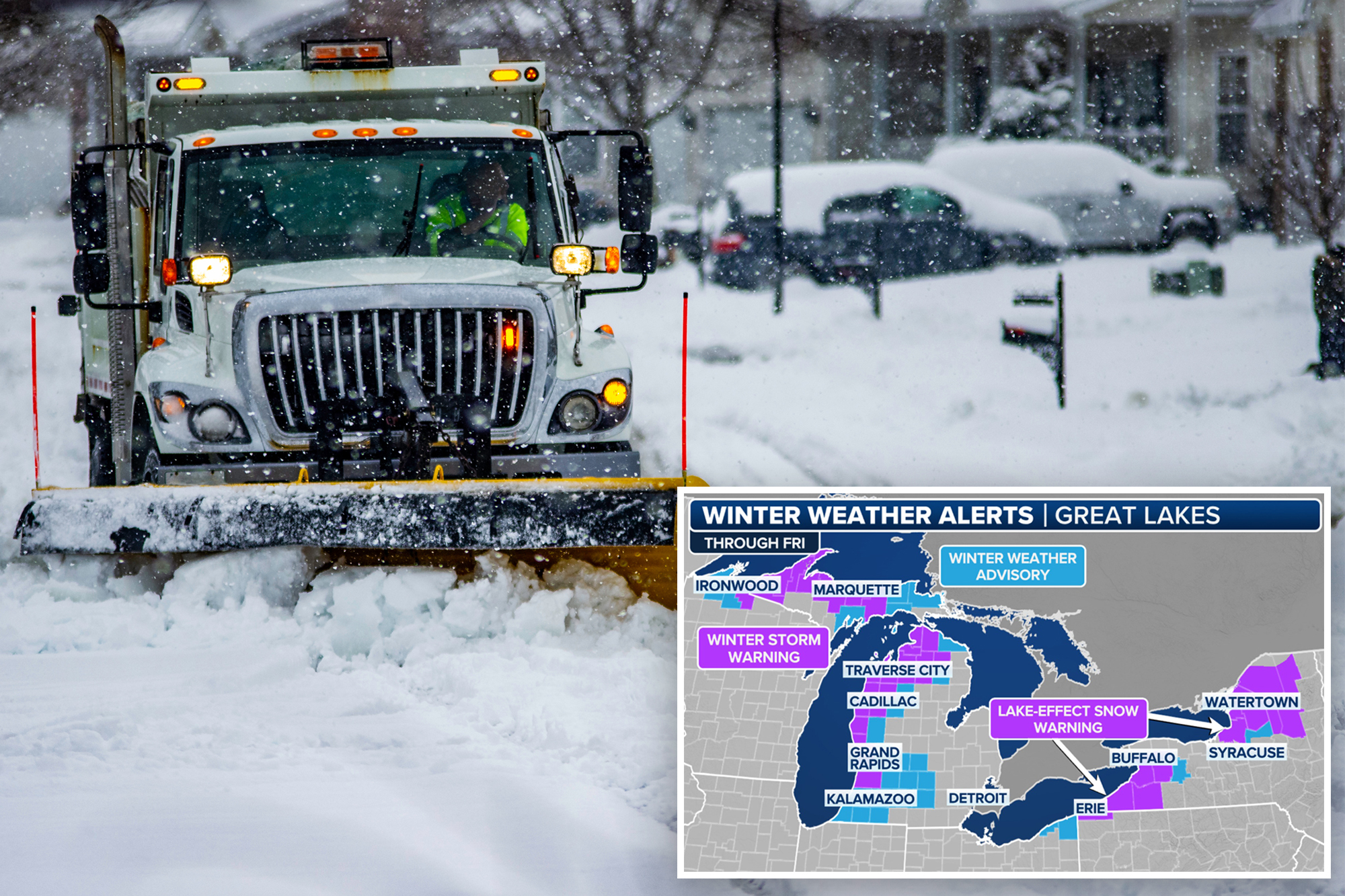
BUFFALO, N.Y. – A significant storm system moving through the eastern third of the country will help trigger another arctic blast and between 10 and 20 inches of snowfall downwind of the major Great Lakes, as Mother Nature’s version of a snow machine ramps back up for the third time in two weeks.
The National Weather Service in Buffalo said heavy lake-effect snow will bring multiple feet of accumulation east of Lake Erie and Lake Ontario through Friday morning. Strong winds will produce near-whiteout conditions at times.
“There will be MAJOR impacts to travel and society during this time,” the agency warned.
The FOX Forecast Center said cold air from Canada is expected to pour over the still-warm Great Lakes, helping to enhance snowfall for communities along the eastern and southern shores of the lakes, starting Wednesday and lasting through Friday.
“On the backside of the Wednesday wallop, we’ve got really cold, blustery air that’s going to be coming its way into the Great Lakes region, and that’s going to allow for the development of some pretty impressive snow bands,” FOX Weather meteorologist Kendall Smith said.
The combination of gusty winds and blowing snow is expected to lead to near-blizzard conditions, especially Thursday when winds peak at 25 to 45 mph.
Interstates such as 90 and 81 in New York are the primary routes that are expected to receive significant snowfall, which is expected to impact travel.
“If you must travel, keep an extra flashlight, food, and water in your vehicle in case of an emergency,” NWS meteorologists warned. “Travel will be very difficult with deep snow cover on roads and very poor visibility. Areas of blowing snow will significantly reduce visibility.”
Since the end of November, more than 70 inches of snow have fallen between Erie, Pennsylvania, and Buffalo, New York, making post-Thanksgiving travel nearly impossible. Snowdrifts of 4 to 8 feet have even caused snow removal crews to get stuck in the winter weather.
Similar conditions were experienced north of Syracuse, New York, where residents spent weeks digging out from feet of snow.
Several deaths were attributed to the event, with health issues related to snow shoveling and vehicle crashes reported throughout the Great Lakes.
A significant warm-up over the weekend and into next week will halt the snow machine, leading to rapidly melting snow, which could cause flooding problems in the medium- and long-term forecasts.
Forecast models show temperatures in the region climbing 10 to 20 degrees by the weekend, which will help to melt any snow that falls over the next few days.


