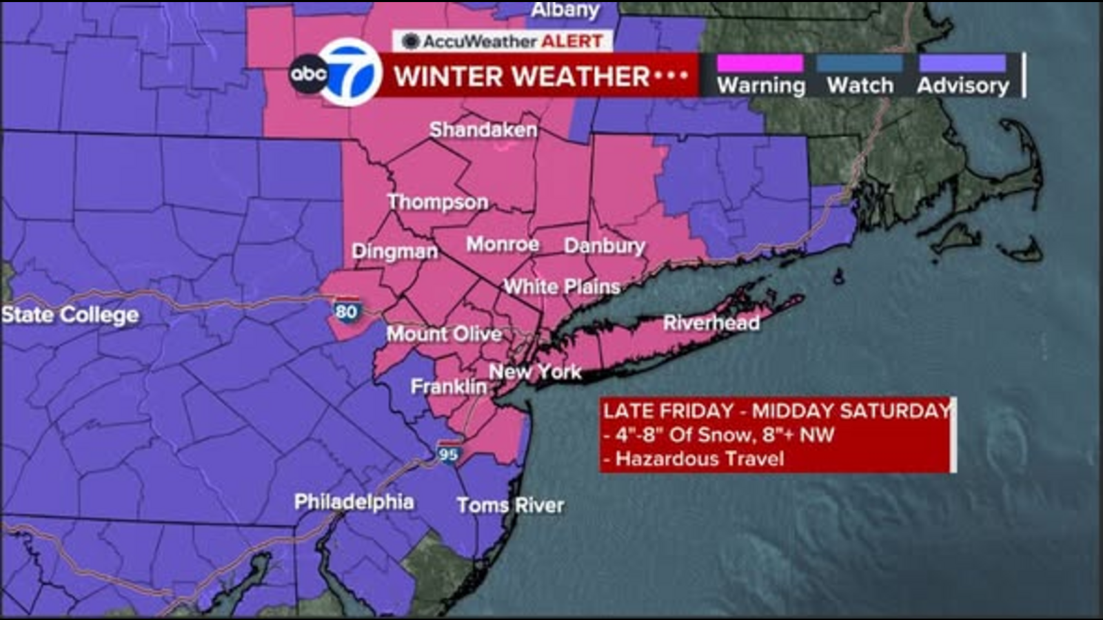
NEW YORK (WABC) — A Winter Storm Warning has been issued ahead of a powerful winter storm that could bring significant snow to New York City and the Tri-State area Friday evening through Saturday morning.
The National Weather Service has placed much of the New York City area, northern New Jersey and southern Connecticut under a Winter Storm Warning ahead of what is expected to be the most significant snow storm of the season so far.
Click here for the latest advisories, watches and warnings from the National Weather Service
The storm, which has also prompted Eyewitness News to issue an AccuWeather Alert for Friday and Saturday, is expected to begin moving through the Tri-State Friday afternoon, well north and west by 3 p.m., and hitting New York City by 5 or 6 p.m., its origins traceable to the potent storms hitting California this week. The energy from the storms will combine with Arctic air in the Midwest as it barrels toward the East Coast.
The brunt of the storm will strike Friday evening around 8 p.m. through about 1 a.m. Saturday, but will wind down in a hurry, with lighter snowfall continuing well into the morning until midday, but with little to no accumulations. There could be some late breaks off to the north. At its peak, the storm could deliver 1 to 2 inches of snow an hour along with low visibilities, making travel extremely hazardous.
Officials are urging residents to prepare for heavy snow and slippery road conditions. New York City Emergency Management has issued a travel advisory for Friday evening into Saturday, with both Mayor Eric Adams and Gov. Kathy Hochul urging New Yorkers to exercise caution if they have to travel.
Click here for the latest AccuWeather forecast.
Our latest snowfall map calls for a widespread area of 4 to 8 inches, including New York City. The heaviest bands are likely to set up across the Catskills, Poconos, northernmost New Jersey, and the Hudson Valley, where totals could range between 8 to 12 inches. The biggest wildcard is that the heaviest bands could get into New York City and western Long Island.
Sleet mixing with the snow is likely to cut down amounts south of Interstate 78 in New Jersey, with 2 to 4 inches expected in southern New Jersey. Lesser amounts are also expected on eastern Long Island and eastern Connecticut, where drier air will move in.
Ultimately, snow could turn to a mix in the city by later Saturday morning, when the storm will wind down rapidly, but travel could still be hazardous.
Temperatures will stay cold on Saturday, barely rising above the freezing mark, even as snow tapers off, meaning there will be minimal melting.
Temperatures rise into the 40s on Sunday along with some rain and an icy mix north and west, but the reprieve will be short-lived as an Arctic blast blows in for the early part of the final few days of 2025.
This is a developing story. It will be regularly refreshed with the latest updates from the Channel 7 Eyewitness News AccuWeather team. Check back for the very latest forecasts.
———-
* Get the AccuWeather App
* More AccuWeather
* Follow us on YouTube
* More local news
* Sign up for free newsletters
* Download the abc7NY app for breaking news alerts
Have weather photos or videos to share? Send to Eyewitness News using this form. Terms of use apply.


