July 16, 2025
From: Monroe County Emergency Management
Final Brief – Risk of Excessive Rainfall in the Florida Keys Ended.
*** NO WATCHES, WARNINGS OR ADVISORIES ARE IN EFFECT FOR THE FLORIDA KEYS AT THIS TIME ***
A broad area of low pressure moving westward across the Florida Panhandle is forecast to continue moving westward and could emerge or redevelop over the far northeastern to north-central portion of the Gulf later today or tonight, reaching the coast of Louisiana by Thursday. Conditions appear generally favorable for additional development if this system moves far enough offshore. The system has a medium chance (40%) for tropical cyclone development over the next 48 hours.
However, this weather disturbance does not pose a threat to the Florida Keys, and the risk of excessive rainfall and local street and poor-drainage area flooding has ended. However, the chance for showers and thunderstorms will remain higher than average for mid-July through Thursday.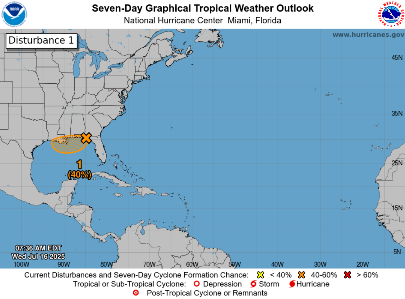
For additional information, visit the NWS Key West webpage at: http://www.weather.gov/key
View live webcams from all over The Florida Keys.
Follow The Florida Keys & Key West on social media:
© Monroe County Tourist Development Council
Privacy policy | ADA website compliance
